Benny's Trail
0.8 mi · The deer pathA shady walk along the waterfall, with refreshing springs all along the creek bed.
Watch on YouTube
Each trail is named for a friend who walks it every day. An illustrated interactive map is on its way — for now, meet a few of the paths.
Follow the winding paths through the sanctuary's woodlands.
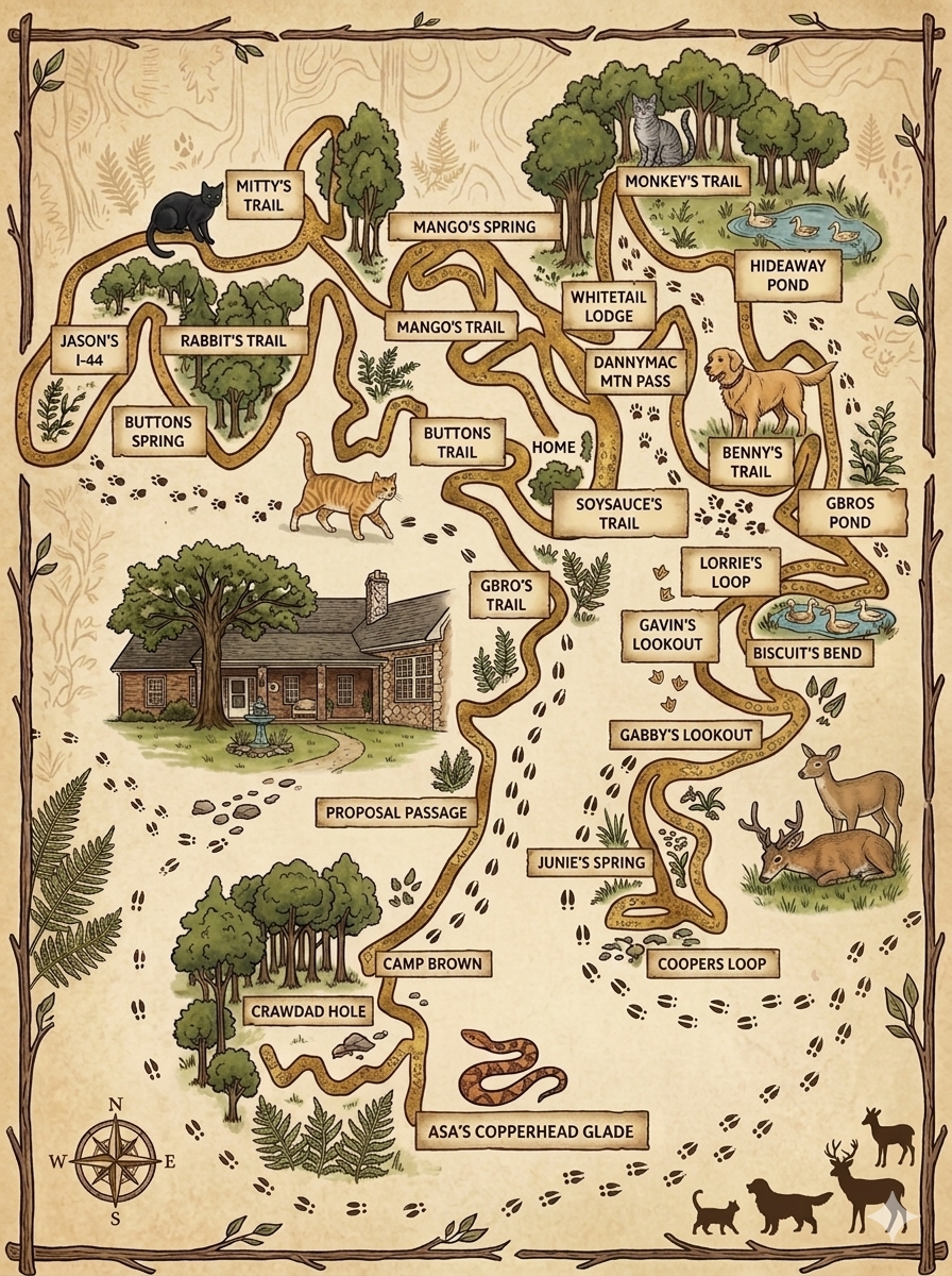
A shady walk along the waterfall, with refreshing springs all along the creek bed.
Watch on YouTubeA long winding path through the woods, leading to a beautiful waterfall.
Watch on YouTubeNamed after the doe who roamed these woods for over 13 years, whose legacy lives on through her many offspring.
Watch on YouTubeTowering trunks, filtered light, and the golden retriever who claimed it first.
Watch on YouTubeClimb to the ridge where the light spills through the trees just before dusk.
Watch on YouTubeLeading from the home, this trail is used daily by Lorrie, her husband, Jason along with the cats, dogs and deer.
Watch on YouTubeA breathtaking path along ledgestone stacked rocks, named after our beloved SoySauce who was our first cat to follow on the trails.
Watch on YouTubeA winding trail leading to G-Bro's Puddle and Half Pint Pond, built by Lorrie's husband to water the wildlife on the trails.
Watch on YouTubeThe heart of the sanctuary — where the water boils for tea, the dogs collapse on the porch, and the ducks knock politely at the door.